
 | DATA – GENEVA NEIGHBORHOODS |
Colored portions of the map below show Geneva neighborhoods by census block groups, which are smaller than census tracts. Mouse over each neighborhood to see the name of the neighborhood, total population, percentage white and percentage black.

Source: Census Bureau
ALSO SEE: OPPORTUNITY ATLAS
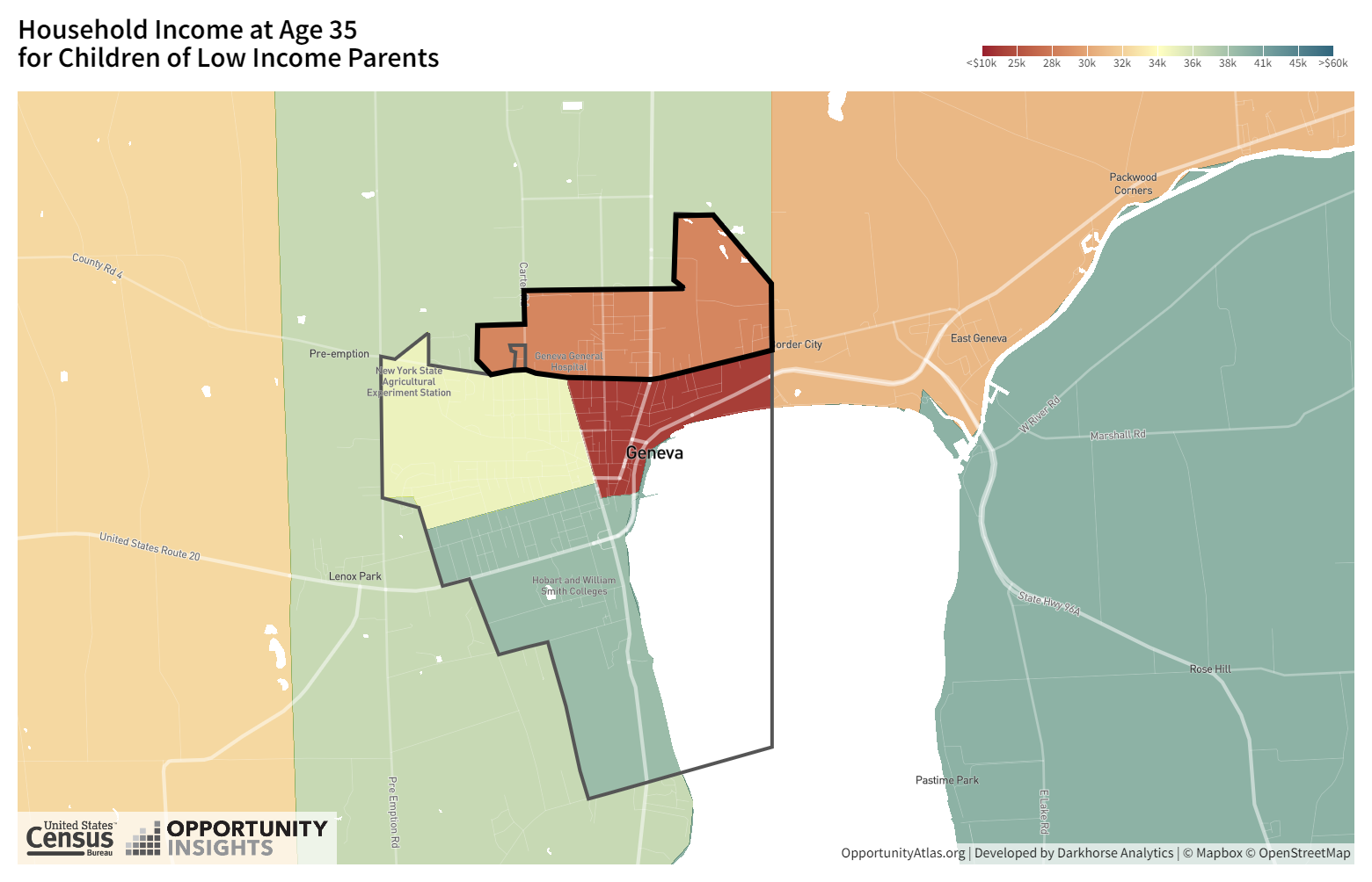
The Opportunity Atlas, a collaborative effort of the Census Bureau and academic researchers, uses neighborhood-level data to predict children’s later lives. The site examines adult poverty, earnings, incarceration rates and other factors, based on where people grew up. The map below links to Geneva data.